
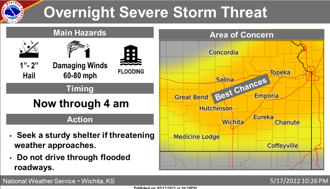
The threat of severe storms will continue over central and northeast Kansas and move into south-central and southeast Kansas overnight.
At 10:16 PM, a 56 mph wind gust was reported at the airport in Salina.
Through 11 PM: A line of severe thunderstorms over central Kansas will move southeast around 45 mph into south central Kansas. Damaging wind gusts to 70 mph will be possible #kswx pic.twitter.com/JjDstTXamz
— NWS Wichita (@NWSWichita) May 18, 2022
10:05 pm: Severe storms with damaging winds to around 70 mph were located along a line from near Salina to Marquette to Holyrood. The movement was southeast at around 45 mph. If you are in the path of these storms, move to an interior room on the lowest floor of a building.
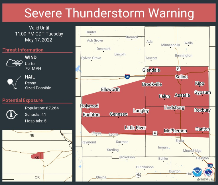
Severe Thunderstorm Warning for Salina until 11 pm. This storm will contain wind gusts to 70 MPH!
Through 10 PM: A line of severe thunderstorms will bring damaging winds to the I-70 corridor across Ellsworth and Saline counties. Storms were racing southeast at 35-40 mph. #kswx pic.twitter.com/83OCr4Czn6
— NWS Wichita (@NWSWichita) May 18, 2022
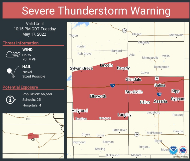
Severe Thunderstorm Warning including Salina until 10:15 pm. This storm will contain wind gusts to 70 MPH!
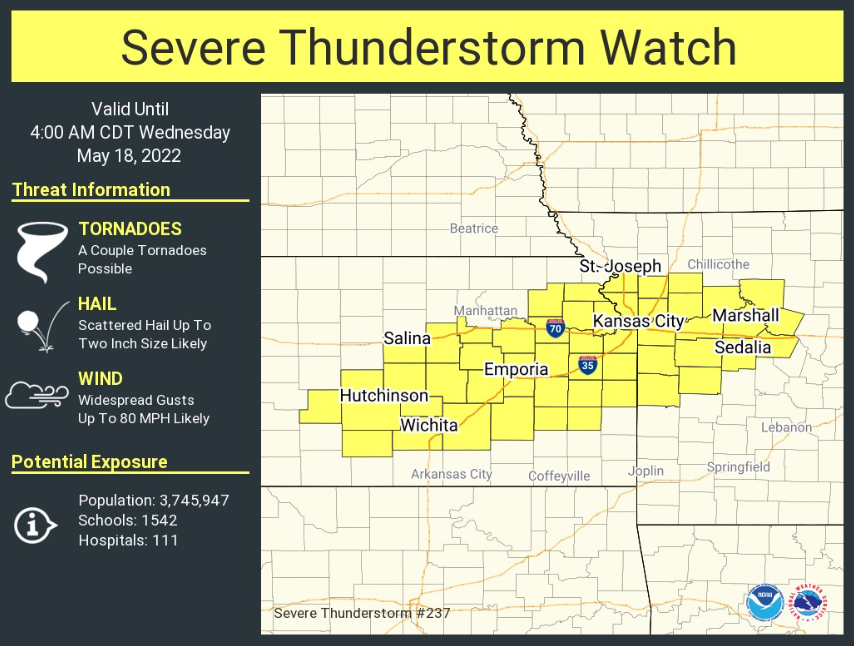
A severe thunderstorm watch has been issued for Saline County until 4 am.