Salina Destination Development, LLC's request to amend the Future Land Use Map of Salina, Kansas Comprehensive Plan was a focal point of discussion during Monday's City Commission Meeting. The application, labeled as #M23-13, pertains to a 41.92 acre tract on the west side of Virginia Drive south of West Magnolia Road. Salina Destination Development seeks to change the land use designation from Future Commercial to Future Urban Residential, supporting the development of multi-family housing in the area.
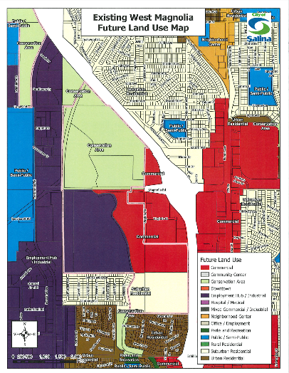
The existing Comprehensive Plan, established in 2010, guides the city's growth areas and development based on proximity to municipal facilities. It encompasses considerations such as roads, water, sewer, fire and police protection, schools, and parks. The Future Land Use Map within the Urban Service Area provides a framework for future decisions, emphasizing comprehensive and long-range planning.
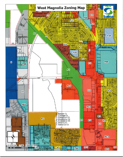
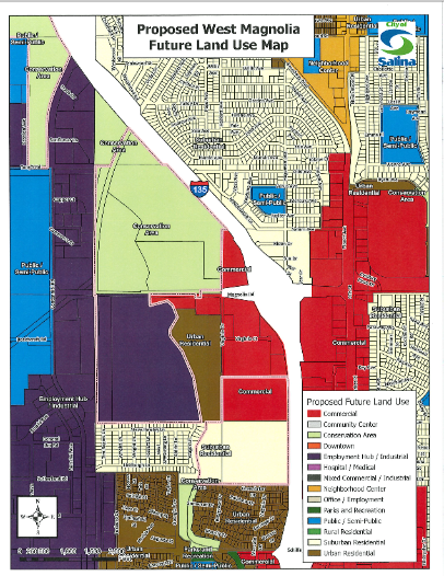
Originally designated as future Commercial in 2010 due to commercial development expectations, the property at the southwest corner of Magnolia Road and I-135 is now subject to change. Salina Destination Development purchased the 41.92 acre tract and proposes multi-family apartments instead of commercial development. The request aims to align the land use designation with their application for R-3 (Multi-Family Residential), reflecting a community need for housing over commercial development.
The Comprehensive Plan acknowledges the dynamic nature of development and recommends periodic reviews. The applicant justifies the amendment based on changing community conditions, a documented shortage of multi-family housing, and the success of Salina's economic development program attracting new industries. The amendment aligns with the Comprehensive Plan's goals for community-neighborhoods and housing.
Staff Comments:
- The amendment is justified by changing conditions, addressing a need for affordable multi-family housing.
- The amendment aligns with the Plan's goals by providing needed rental housing units.
- There is a public need for the amendment due to housing needs, and changing the land use designation serves this need.
- The change would not negatively impact surrounding areas, as the property is adjacent to existing commercial development.
After a public hearing, the Planning Commission voted 5-0 to recommend amending the Future Land Use Map. They propose designating the southern portion of the 41.92 acre tract as Urban Residential while retaining the Commercial land use designation along Magnolia Frontage Road.
There will be no direct fiscal impact on the City as a result of this land use map amendment.
The approval passed 5-0.