
This is a brand new feature for all of our premium and print members.
As a news organization we receive a continuous supply of emails asking about incidents that are happening around town. "What are the sirens for on Santa Fe?", "What is happening on I-135 and Schilling?", etc.
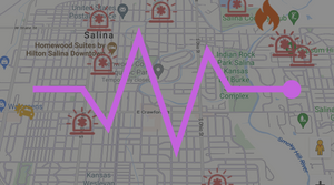
So, we have automated the police scanner traffic and other event-based channels. With a mix of new AI technology we are interpreting the traffic on the scanner and appending each incident to the map. A few important notes:
- No addresses are shared, we are encoding the latitude and longitude of the address.
- Detailed chatter of incidents are not shared for privacy purposes.
- This map will soon cover all events going on around town (e.g. If there's a concert at the Stiefel, it will appear on the map).
- This is a beta release. It's not perfect yet, but we're working to improve it.
- If any incident occurs that is important for the safety of the public, it will instantly be made available to anyone.
For premium/print members who want access, you will be able to view the incident map any time here: